Home »

Angling closures announced for south Kootenays
The Government of B.C. is suspending angling for the southern Kootenays due to ongoing warm water temperatures and low flows.
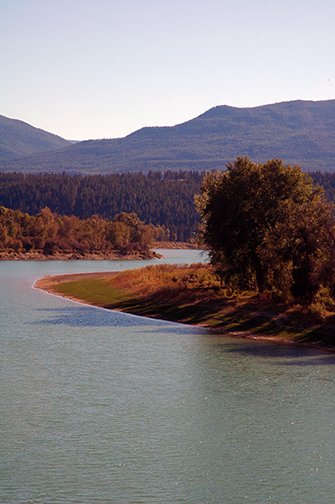
Effective Aug. 15 through Sept. 15, virtually all angling in streams and rivers in Wildlife Management Units 4-3 through 4-9 is suspended. The closure has been put in place to protect fish stocks at a time when they are vulnerable due to low flows and high water temperatures. The geographic area covers a belt of territory across the southern Kootenays geographically south of Nelson, from below Lower Arrow Lake in the west across to the Kootenay River, east of Cranbrook.
In addition, Michel Creek, Coal Creek, Lizard Creek, Sand Creek, Kikomun Creek and Morrissey Creek and their tributaries will be closed to angling in the East Kootenay. These streams are in Wildlife Management Units 4-02, 4-22 and 4-23. Other streams in these twowildlife management units are unaffected.
The Columbia River from the Hugh Keenleyside Dam to the Washington State border, and the Kootenay River from Brilliant Dam to the confluence of the Columbia River are exempt from the closure at this time. On these two streams fishing can continue as normal. These streams have sufficient water refuges to adequately protect fish, even with normal angling pressure.
B.C. government fisheries biologists are monitoring approximately 30 other key angling streams across the province, and if conditions warrant, additional closures are possible. Angling closures are enabled through the British Columbia Sport Fishing Regulations of the federal Fisheries Act.
To see a complete list of stream closures made earlier in the season due to low flows and high temperatures go HERE.
e-KNOW