Home »

Rosen Lake most disturbed in region
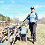
Thanks to the most shoreline disturbance, Rosen Lake at Jaffray is the most disturbed lake in the East Kootenay.
Regional District of East Kootenay (RDEK) directors August 3 received a report from Heather Leschied of the East Kootenay Integrated Lake Management Partnership (EKLIMP), who outlined what the partnership has accomplished in the past six years and what its priorities are moving forward.
Leschied, who managed the Lake Windermere Project through to its completion in 2010, noted that eight regional lakes have been the focus of a Sensitive Habitat Inventory Mapping (SHIM) program, looking at natural versus disturbed shorelines.

Only about seven per cent of Rosen Lake (pictured above) is considered ‘natural’ shoreline, making it the most disturbed lake in the region. Lake Windermere, the first lake to be studied, is the second most disturbed lake with about 40% of its shoreline remaining natural. Wasa Lake is close behind in third place with about 38% of its shoreline remaining natural.

About 50% of Moyie Lake’s shoreline remains in its natural state, while Columbia Lake, with its eastern shoreline free of development, has about 65% natural shoreline. The three best lakes of the eight studied are JimSmith Lake (75% natural shoreline), and St. Mary Lake and Monroe Lake, with both about 80% natural.

“With the completion of the eight lakes, the partnership recognized that we needed to establish a monitoring and compliance framework to ensure we were being effective with the SHIM process. We wanted to know if the Shoreline Management Guidelines were being followed,” Leschied told the regional board.

“Monitoring took place on Windermere and Moyie lakes in 2010, and on Wasa and Columbia lakes in 2011. This year the partnership will do further monitoring on Moyie and also complete Rosen Lake. In each case DFO staff conducted a shoreline survey to assess the level of compliance of foreshore projects. Results varied by lake, but evidence did show that further education is required around the permitting process for completing shoreline projects,” she said, explaining the SHIM process is comprised of a foreshore inventory, a fish and wildlife habitat assessment “and the resulting Shoreline Management Guidelines. Provincial and federal government biologists, along with support from the partnership, conduct field assessments which document land use, shore type, habitat value, and level of impact. Through a complex matrix and analysis of the data, an aquatic habitat index is assigned to the shoreline segments.”

Leschied cited Moyie Lake as an example, showing a slide of a map of the lake, with the lake’s north end highlighted in red. “It has a very high habitat index rating, has a natural shoreline, has a low level of impact and is adjacent to a stream mouth, which important fish habitat,” she said, explaining, “This information is used by decision-makers, planners, developers, land-owners and government agencies to identify where shoreline development is and is not appropriate, based on those ecological values.”
Leschied also noted that the lakes with a railway line running along them are all disturbed, which accounts for many of the lakes in the region, including Windermere, Columbia and Moyie.
EKLIMP found legs six years ago because of the “intensification of development proposals in the Columbia Valley and other East Kootenay lake areas. In some cases there was conflicting policy information or direction for different agencies, or poor communication between agencies,” Leschied said, adding, “Interest in coordinating efforts lead to the development of the East Kootenay Integrated Lake Management Partnership.
“The partnership consists of representatives from each agency with jurisdiction over the lake or portions of, and other community groups. Core partners include RDEK, Department of Fisheries and Oceans, Ministry of Forests, Lands and Natural Resource Operations, Canadian Columbia River Inter-tribal Fisheries Commission, and the various community associations,” she outlined.

“Together the partnership developed and endorsed a Terms of Reference, establishing our mission, which is to work together, to share information and resources, and collaborate on lake management projects that address current and future activities in the watershed in a way that would sustain the ecological health, social and economic values of lakes in the East Kootenay.
“Our main priority has been to conduct SHIM projects, which uses a protocol developed by Fisheries and Oceans Canada to assess the health of fish and wildlife habitats.
“The information is used to create Shoreline Management Guidelines to direct development activities in a manner that will protect existing fish and wildlife values, while taking into account cumulative impact to overall lake health,” she noted.
EKLIMP has held public open houses at the lake communities to present the mapping work and results, and all reports can be found on the RDEK website under the Planning Department.
“Lastly, a key component of this ecosystem based approach to lakeshore management has been monitoring and compliance, which measures the project’s effectiveness,” Leschied said, explaining Lake Windermere “was selected as our pilot SHIM project due to the high development pressures, existing fish and wildlife values, source water protection issues and an engaged local community. There has since been so much interest in SHIM from elsewhere in the East Kootenay that EKILMP had to develop a list of criteria in which a lake had to meet in order to be considered priority.”

The success of the program has filtered through to the West Kootenay.
“Our work is being used as a model for Slocan and Kootenay Lakes in the West, in fact, Kootenay Lake has developed its own partnership -the Kootenay Lake Partnership,” Leschied told the board.
EKLIMP intends to continue with its work, she added.
“Moving forward, the partnership has developed a five-year rotational schedule to re-run the aquatic habitat index for each lake, taking into account any new modifications or restoration. This will help us gain an understanding of whether aquatic habitat values are increasing or decreasing for East Kootenay lakes,” she said.
But EKILMP recognizes that lake management doesn’t stop there.
“There are other factors that need to be considered, like other environmental values such as water quality and quantity, and economic and social values too. EKILMP is also investigating the possibility of incorporating archaeological values, as is being done for Kootenay Lake. However, SHIM can in the least provide the science to direct the ecological components of a lake management plan,” Leschied stated.
The work wouldn’t have begun if it wasn’t for an engaged regional board and District of Invermere council, she continued.
“Because of the efforts of the RDEK and DOI, and I do need to recognize specifically the efforts of directors Gerry Taft (Invermere) and Wendy Booth (Electoral Area F) who have been very much engaged in this process, a Lake Management Plan for one – Lake Windermere is done and I should also mention that Columbia Lake already has a management plan in place,” she said.
By providing such information about regional lakes, important planning aspects can be incorporated to ensure healthier lakes moving forward, Leschied said.
“On their own shoreline management guidelines are simply guidelines, but by incorporating them into an Official Community Plan or Lake Management Plan the guidelines become part of the planning bylaw,” she said, adding, “As part of the Lake Management Plan, Lake Windermere is currently going through the creation of surface water zoning, and development permit areas, using the SHIM results as guidance. In addition to the West Kootenay, Parks Canada is also looking to us as an example for their lake management planning processes in Riding Mountain National Park; Living Lakes Canada is using it for Lake Winnipeg, the world’s 10th largest freshwater lake, and the Federation of Ontario Cottagers’ Associations is also interested in how SHIM might support the efforts of their more than 500 members. SHIM has been covered on CBC’s Daybreak, and has been highly regarded by the REFBC, to the point where the REFBC approached us with an interest in funding a community engagement role for Kootenay Lake.”
Leschied “gratefully” acknowledged funding partners whom have contributed $246,000 to the partnership since 2006.
“We have managed contracts with four different area consulting firms, contributing to our local economies. In addition to cash contributions, the partnership has provided $267,000 in in-kind services, including volunteer time, use of equipment and meeting space. And I do want to stress the importance of the support we’ve received from the RDEK, which alone has been $34,000 cash, and $30,000 in-kind,” she noted.
Also providing support to the project: the Village of Canal Flats and the Real Estate Foundation of B.C.
Key to each lake study has been “individual champions,” Leschied said.
Regional board chair, Electoral Area C director Rob Gay, said he’s found EKLIMP’s work helpful for the regional government.
“It’s been useful for our ongoing planning. It takes a champion for these causes,” he said.
Electoral Area B director Heath Slee questioned why Tie Lake, close to Rosen Lake, hasn’t been part of a SHIM exercise.
Leschied said a presentation was made to the community two weeks ago. “I imagine it will be up on this list quite soon,” she said.
Regional planning and development services manager Andrew McLeod told the board that “some Tie Lake residents (about a dozen) raised quite a ruckus” about the SHIM process, so one has not yet been done.
“It is rather alarming to see that Rosen Lake is at the top of the list of shoreline impacts,” Slee stated.
Jon Bisset, a senior biologist with the Canadian Columbia River Inter-Tribal Commission, said the SHIM work is providing valuable information.
“It emphasizes that in some of the lakes, that’s where planning becomes really important to protect the sensitive features. It also identifies that there is an opportunity for redevelopment of some sites (restoration). It gives us an opportunity to communicate information out to the public.
Invermere Mayor Taft said when SHIM work began on Lake Windermere, some lakeshore residents feared they would lose docks or foreshore property.
“That’s not the case – at all,” he exclaimed. “More than anything this is setting some science-based information for planning. I don’t think people should be afraid of it. There are no secret American funders.”
Electoral Area G director Gerry Wilkie agreed. “I have followed the work from day one and it’s been outstanding,” he stated.
Cranbrook Mayor Wayne Stetski expressed his appreciation for the work that has been done. “It sets up the East Kootenay as a leader around lake management,” he said.
Canal Flats Mayor Ute Juras pointed out that tourists, and many residents, come to the region because of its beautiful mountain lakes. “They are our crown jewel,” she said.
Moving forward, Leschied said the other large lake in the region, Lake Koocanusa, should become a focus, too.
“As long as we continue to have support from local governments and the other agencies, the project should continue,” she said.
Ian Cobb/e-KNOW