Home »

BCCOS reminds about access closures for caribou
The B.C. Conservation Officer Service (BCCOS) is reminding the snowmobiling public about area access closures, part of the province’s Mountain Caribou Recovery Implementation Plan.
Since 2009, government has closed areas to snowmobile use across the Mountain Caribou range in order to support population recovery.
Today (Feb. 7) on social media, the BCCOS reminded snowmobilers about Wildlife Act access closures and provided a link showing maps.
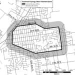
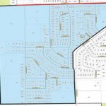
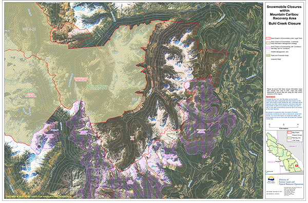
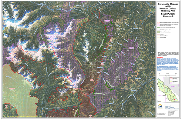
Six of those closure areas are located in all or part of the East Kootenay (55 to 60). The closure areas: Buhl Creek; South Purcells Kootenay Lake N; Mathew Creek; South Purcells Cranbrook; South Purcells Creston; and South Purcells Kootenay Lake S.
The maps are geo-referenced PDFs so they can be used in mobile applications to determine your location relative to boundaries, open riding areas and trails.
Lead image: BCCOS reminds the public officers monitor the backcountry from the air and on the ground. Photo courtesy BCCOS
 e-KNOW