Home »

BCWS keeping close eye on expanding Bill Nye
The Bill Nye Mountain wildfire continues to burn out-of-control seven kilometres southeast of Wasa, with BC Wildfire Service today (July 19) reporting it is an estimated 873 hectares.

“Fire behaviour continues to be a low to moderate surface fire, with flare-ups when pockets of previously unburned fuels are found. The majority of fire growth is happening upslope into higher elevations,” BC Wildfire Service (BCWS) stated in its most recent report.
“Crews and heavy equipment made good progress on both the machine guard and hand-built fuel free at the base of the hill. Ground crews and heavy equipment will continue with that work on scene today. A helicopter is supporting with bucketing activities and flying officers so that they can monitor fire growth.”
As a result of the steep terrain, only five firefighters, two pieces of heavy equipment and a helicopter are being utilized in the battle.
“The Southeast Fire Centre is sharing resources for all priority wildfires and responding to incidents accordingly. The top priority is always human life and safety. The second priority is property. The third priority is the protection of areas with high environmental values including community watersheds and species at risk. The fourth priority is resource values,” BCWS stated in its wildfire of note report.
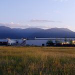
An evacuation alert is in place for 54 properties in the Lazy Lake, Lakit Lake, Holmes Road, and Wildhorse FSR areas.
The lightning-caused Tanglefoot Creek wildfire, discovered July 16 about 15 km southeast of the Bill Nye fire, remains out-of-control at 195 ha, the same scale as reported yesterday.
As of noon (July 19), only one new fire has been reported overnight.
It is a lightning-caused fire in “Forsite,” located on a slope on the east side of White River, 28 km northeast of Canal Flats. The fire is an estimated .3 ha.
Fourteen km due south of that is the lightning-caused Ptarmigan Creek wildfire five km north of Whiteswan Lake Provincial Park. The fire remains out-of-control at 18 ha.
BCWS reports the lightning-caused fire reported yesterday in Drinkwater Creek, about 5.5 km south of Morrissey, is still out-of-control at .01 ha.
The lightning-caused fire discovered July 16 in Dewar Creek about 2.5 km west of Price Lake in St. Mary Alpine Provincial Park, about 36 km northwest of Kimberley, remains out-of-control at 42 ha.
Five other East Kootenay wildfires appearing on the BCWS Wildfire Dashboard are under control.
The official BC Wildfire Service mobile app provides real-time wildfire information and an interactive map that users can customize to display a variety of fire-related data.
Lead image: Evacuation alert information posted on the Lazy Lake Campground sign. Ian Cobb/e-KNOW photo
e-KNOW