Home »

BCWS working on control line for Bill Nye
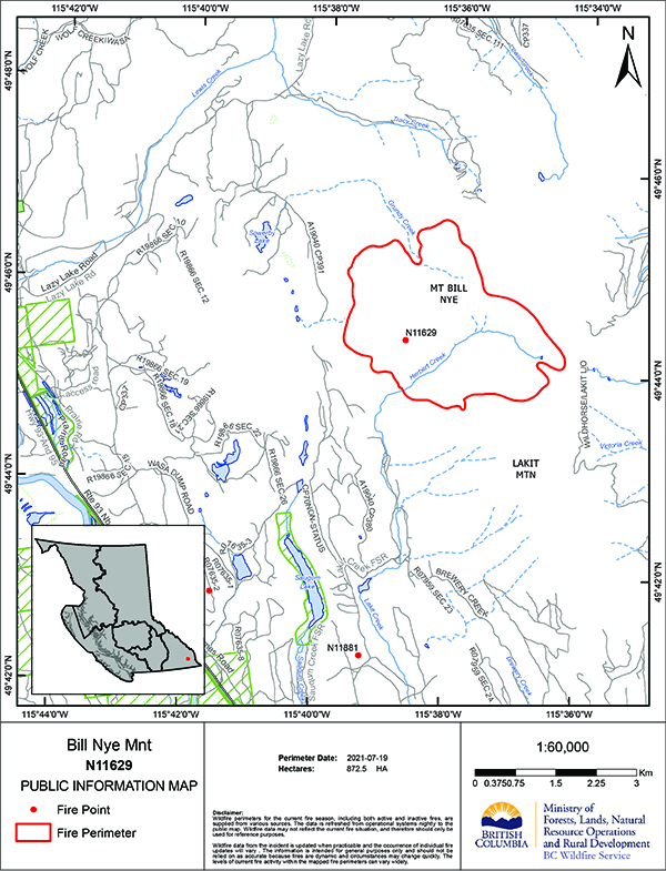
BC Wildfire Service (BCWS) this morning (July 20) reported it continues to try and angle the Bill Nye Mountain wildfire, now an estimated 956 hectares into more workable terrain.
The lightning-caused fire discovered July 10 seven kilometres southeast of Wasa has prompted an evacuation alert for 54 properties in the Lazy Lake, Lakit Lake, Holmes Road, and Wildhorse FSR areas.
“A low to moderate surface fire continues to be observed. Flare-ups are noticed as pockets of unburned fuel are found. The fire did move downslope while fuel finding and while the fire was more visible to the community, growth was minimal,” BCWS reported.
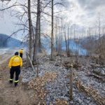
“Equipment is nearing completion of the guard at the base of the hill. Helicopters were quick to work on a pocket of increased activity that happened in the morning hours to cool down the hot spots.
“Today’s objective is to complete the machine build control line to the south and link it into pre-existing logging roads on the west side. The fuel-free on the north will be tied off to Lazy Lake in an effort to steer the fire into more workable terrain.’
Today there are five firefighters, a helicopter and two pieces of heavy equipment fighting the fire, which is the largest of the 10 current wildfires in the East Kootenay.
Five of the 10 fires, including Bill Nye, are out-of-control.
The lightning-caused Tanglefoot Creek wildfire, discovered July 16 about 15 km southeast of the Bill Nye fire, is now out-of-control at 288 ha.
The lightning-cause fire near Big Lake south of Wasa, discovered July 13, is being held at 11 ha.
The lightning-caused fire discovered July 16 in Dewar Creek about 2.5 km west of Price Lake in St. Mary Alpine Provincial Park, about 36 km northwest of Kimberley, remains out-of-control at 58 ha, up from 42 ha yesterday.
The lightning-caused fire in Forsite, discovered July 19, located on a slope on the east side of White River, 28 km northeast of Canal Flats. The fire is an estimated .6 ha.
And 14 km due south of that is the lightning-caused Ptarmigan Creek wildfire five km north of Whiteswan Lake Provincial Park, which remains out-of-control at 18 ha.
The lightning-caused fire reported July 18 in Drinkwater Creek, about 5.5 km south of Morrissey, is now under control at .09 ha.
The Moyie River/Lumberton fire is still under control at 29 ha.
The Granite Creek wildfire in the Purcell Wilderness Conservancy, discovered July 3, is being held at 26 ha.
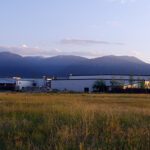
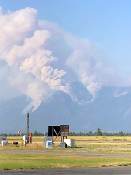
 Lead image: A view of the Bill Nye Wildfire from Kimberley on Saturday, July 17. Ian Cobb/e-KNOW photo
e-KNOW