Home »

East Kootenay Wildfire Update
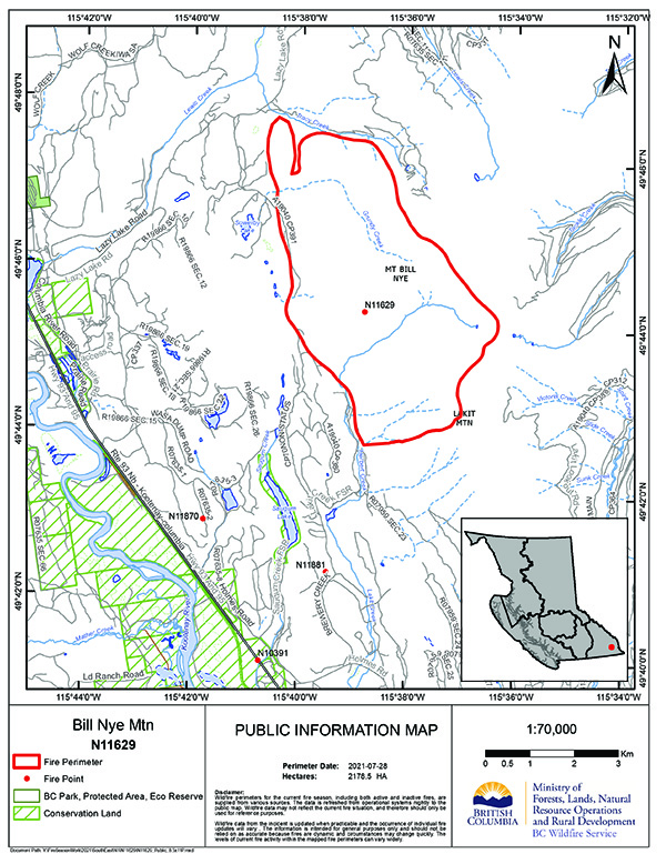 The Bill Nye Mountain Wildfire, burning since about July 8 seven km southeast of Wasa, is now an estimated 2,054 hectares.
BC Wildfire Service (BCWS) today reported the fire grew an estimated 50 hectares on July 29.
“Personnel plan to map the perimeter the morning of Friday, July 30. Expect to see a change in size once this is complete. Growth is to the north, where the fire is backing down a north-facing slope. The fire is currently sheltered from prevailing winds, muting its activity.
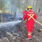
“Structure protection units arrived at the incident the evening of Thursday, July 29, and implementation is underway. On Friday, crews continue working toward current objectives for this fire: laying out and constructing control lines to the north of the fire to protect structures and build toward containment. Helicopters continue to fly personnel above the fire to monitor growth and fire behaviour on all flanks, and provide bucketing to support containment within control lines. Heavy equipment continues work to construct a machine guard along the north flanks and around structures,” BCWS outlined.
Today there are 49 firefighters, three helicopters and seven pieces of heavy equipment on the fire.
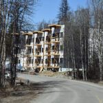
An evacuation order and an evacuation alert are in effect in the vicinity of this fire.
An area restriction in the vicinity of this fire is in effect.
The region’s second fire of note burning in the Mineral Creek area, 25 km southwest of Invermere, remains out-of-control at 103 ha.
Despite the fact the entire East Kootenay is in either extreme or high fire danger, BCWS reports no new fires today.
The Tanglefoot Creek fire, discovered July 16 about 15 km southeast of the Bill Nye fire, remains out-of-control but holding in size at 325 ha.
The lightning-caused fire discovered July 16 in Dewar Creek about 2.5 km west of Price Lake in St. Mary Alpine Provincial Park, about 36 km northwest of Kimberley, is still out-of-control at 58 ha.
The nearby fire at Armour Creek, nine km southwest of the Dewar Creek fire and about 26 km northeast of Riondel, is still out-of-control at 154 ha.
The lightning-caused Ptarmigan Creek wildfire five km north of Whiteswan Lake Provincial Park remains out-of-control at 62 ha.
The fire along Marian Lake Forest Service Road, eight km northeast of Castledale on the east side of Castle Mountain, is now under control at 40 ha. An area restriction is now in place.
Lead image: Map showing location of the Bill Nye Mountain Wildfire as of July 28. BCWS map
e-KNOW