Home »

Join Our Great Trail Celebration
 The Cranbrook to Wardner Destination Trail
By David B. Savage
Imagine your group celebrating Canada’s 150th birthday by hosting your own event on the next portion of The Great Trail.
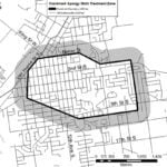
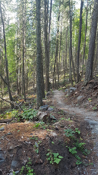
Our Cranbrook to Wardner Destination Trail (C2W Trail) is world class and will be complete for Canada’s 150th birthday. The photo (below) is taken on the Mt. Baker section midway in the 42.5 km (26 miles) non-motorized trail. Although the C2W Trail is not a wilderness trail, some parts have a distinctive “out there” feel to it.
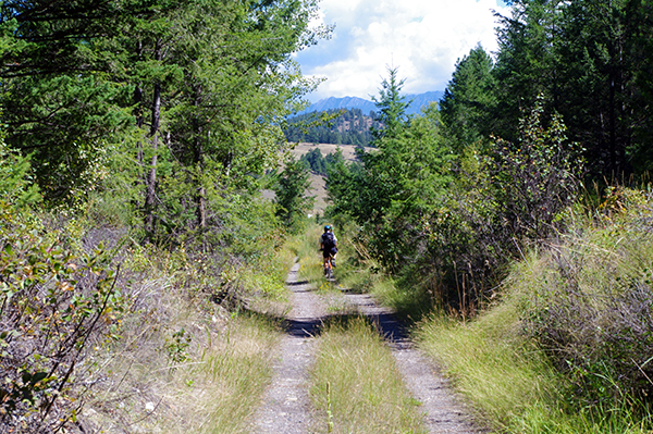
Did you know that from the Isadore Canyon Trailhead in Cranbrook to close to Wardner, you will not see any residence buildings along the trail for over 35 kms! Our C2W Trail is an important part of the Great Trail/ TransCanada Trail. The Great Trail totals 21,500 kms and connects the Pacific to the Arctic to the Atlantic oceans.
 The C2W Trail combined with the already popular NorthStar Rails-to-Trails will provide a wonderfully enjoyable trail experience of over 70km. Thus making this the longest greenways section of the Great Trail in the BC interior.
We have been told the Cranbrook to Wardner Destination Trail is one of the best sections of the Great Trail with our mix of rail trail and mountain switchbacks. All of it can be enjoyed for free by walkers, bike riders, skiers, snow-shoers and horsemen. The C2W Trail has been build by the hard work of many volunteers (especially Al Skucas) and funding from many sources (including the TransCanada Trail, Teck, the RDEK, CBT and more).
For the week in advance of and following Canada’s 150th birthday on July 1, we are organizing events for the celebration. We are targeting the grand opening of the C2W Trail for July 1. We are inviting all regional groups to join us.
Objectives of our planned celebration(s);
To promote our region,
To promote healthy lifestyle,
To promote sustainable tourism,
To promote the TransCanada/ Great Trail,
To promote our Cranbrook to Wardner Destination Trail, and
To thank everyone for being part of the creation of the C2W Trail.
 Imagine starting with Canada Day celebrations in Cranbrook and Fort Steele then being part of a bike ride and hike from Cranbrook to Rampart to Mt. Baker to Mayook to Wardner then enjoying a celebration BBQ and entertainment at Wardner for the evening. You can even campout in Wardner.
Imagine organizing your own club’s event during the week before and after where your friends and associates get on the C2W Trail and celebrate in your own way.
Imagine your Service Club helping us host a great day for our region.
Imagine a C2W Trail Marathon running the 26 miles.
Imagine a network of people to care for and promote the Cranbrook to Wardner Destination Trail for our future.
Imagine a day to thank our volunteers and neighbours.
Imagine…
We are ready to speak to your group and collaborate to meet our and your objectives.
Already our C2W Trail Celebration Steering Committee is organizing the July 1 event, a Name the Trail program with the Ktunaxa Nation, trail completion and volunteer activities, a collaboration with a number of organizations for Canada Day chaired by the City of Cranbrook, an interpretive program and signage to highlight the historical, cultural, ranching, mining, railroad and Ktunaxa history and significance along the C2W Trail.
We invite your contact, ideas and proposals to make our area even better for us, those we wish to attract to live here and to bring tourists to ride, hike, ski… the incredible trails we now have from Elkford to Sparwood to Fernie, to Elko, to Kookanusa, to Wardner, to Mayook, to Cranbrook, to Kimberley, to Grey Creek…. to the Pacific, Arctic and Atlantic.
Our Steering Committee includes Al Skucas, Rob Gay, Barb Fisher, Neil Shuttleworth, Riley Wilcox, Chris New, Wayne Stetski, David Hull, Lillian Rose, Natasha Burgoyne, David Savage and others.
For more information on ways to get involved, please contact [email protected] and check out our Facebook page.
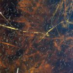
Lead image: The view of the Kootenay River from the trail, on the Ha Ha Road to Steamboat Hill Section.