Home »

The EK – a geographical view
The East Kootenay is 27,560 square kilometres (10,641 sq. mi.).
It is slightly larger than Rwanda and a touch smaller than Haiti, twice the size of The Bahamas and more than 10 times the size of Luxembourg, the world’s 177th largest nation.
The East Kootenay comprises .002 per cent of Canada’s landmass (9,984,670 sq.km.) — or Canada could hold 362.28 East Kootenays. And no, the correct name is East Kootenay – not East Kootenays.
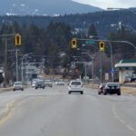
There are about 56,000 full-time residents who call British Columbia’s southeastern corner home, with the largest concentration of them living in the Central Subregion of the Regional District of East Kootenay (RDEK). The cities of Cranbrook and Kimberley make up the bulk of the population of 32,000.
Cranbrook is nestled into an elevated prairie above the Kootenay Valley. Eastward lies the spectacular Steeples Range and heavens-pointing Fisher Peak of the Rocky Mountains. To the south lies sprawling mountain forests, beyond the undulating dominance of Mount Baker, stretching to the Idaho and Montana borders. To the west is a low pass over the Purcell Mountains and beautiful Moyie Lake, along with the picturesque lakeside community of Moyie.
Kimberley is one of Canada’s highest cities, lying along the east slope of the Purcell Mountains at 1,110 metres/3,643 feet above sea level. The city of 7,300 boasts one of the East Kootenay’s five ski hills and is gateway to vast tracts of Purcell Mountain wilderness, including St. Mary’s Lake to the west, where Bootleg Mountain rules supreme. The city provides some of the most dramatic views of the Columbia River Trench to the north and south.
The northern portion of the RDEK, at the headwaters of the Kootenay and Columbia Rivers, is the Columbia Valley, with a population of about 10,000. Invermere, situated at the northern end of Lake Windermere, is the market centre for the valley community. The unincorporated communities of Fairmont Hot Springs and Windermere, along with Panorama Mountain Village, surround the town of 3,900. Between the lakes, ski hill, 15 golf courses, hot springs and boundless natural wild lands, the valley is no longer a sweet secret. As a result its population triples during the peak tourist seasons.
Famous Radium Hot Springs is the most northern municipality in the region. With almost 1,000 residents, it is one of the fastest growing municipalities in B.C. Located at the terminus of Sinclair Creek, which continues to carve its way out of the Rockies into the Columbia River Wetlands to the west, Radium is the gateway to Kootenay National Park, where its world famous hot springs are located. It is also the jumping off point for the spectacular north valley, where the unincorporated centres of Edgewater, Brisco and Spillimacheen are located.
The newest and smallest of the municipalities in the region is the Village of Canal Flats, population 700. Canal Flats, a forestry town, is located at the southern end of Columbia Lake. It is the gateway to the wild and spectacular lands of the upper Kootenay River, as well as to famous fishing lakes such as Whitetail to the west in the Purcell Mountains.
Another valley community comprises the third section of the East Kootenay — the Elk Valley, which has a population of about 14,000. The City of Fernie is the largest of the three municipalities in the Elk Valley, with 4,300 calling it home. Fernie Mountain Resort provides year-round recreation, and the Elk River that runs through the city features some of the finest fishing in the world. Like Cranbrook, the country to the south of Fernie is pure Rocky Mountain wilderness, spanning to the Montana border. The mountain country to the north of the city is equally spectacular Rocky Mountain wilderness.
The District of Sparwood, population 4,000, is the ‘welcome to B.C.’ town on the Crowsnest Pass Highway, 18 km from the Alberta border. A flourishing coal-mining centre, Sparwood, like all other municipalities in the region, is a societal outpost surrounded by wilderness.
Just 35 km from Sparwood, at the ‘start of the road,’ is the smallest of the municipalities in the Elk Valley, Elkford (population 2,500). Coal is still king in Elkford, with several large mines located near the town. Because of its location, Elkford is a classic B.C. wilderness town, with the sub-alpine marvels of Elk Lakes Provincial Park just 69 scenic km north — at the ‘end’ of the road.
Another major geographical aspect of the Elk Valley is the 75 km long(47 mi.) reservoir Lake Koocanusa, 45 km east of Cranbrook. It stretches from Wardner in the north, near Highway 3, to the Libby Dam, 25 km (16 mi.) north of Libby, Mont.
Several small ranching, farming, forestry and tourism communities are located near Lake Koocanusa, including Jaffray, Elko, Wardner and the tiny border community of Grasmere.
Adjacent to Grasmere is the Tobacco Plains First Nations Reserve, one the four Kutanaxa Nation communities in the East Kootenay. Two of the bands are located in the Columbia Valley, with the ?Akisqnuk at Windermere and Shuswap Band at Invermere. The ?Aqam (St. Mary’s Band) is located just north of Cranbrook.
For a more detailed look into the Ktunaxa people, visit: https://www.ktunaxa.org/who/index.html
Ian Cobb/e-KNOW