Home »
Wardle wildfire hits 3,600 ha; Whitetail enters KNP
Yesterday’s short period of cooler temperatures and rain showers limited fire growth and allowed further progress on containment of the Wardle wildfire, Parks Canada reported this morning (August 13).
A long-term forecast for hot and dry weather is expected over the next few days and may increase wildfire activity.
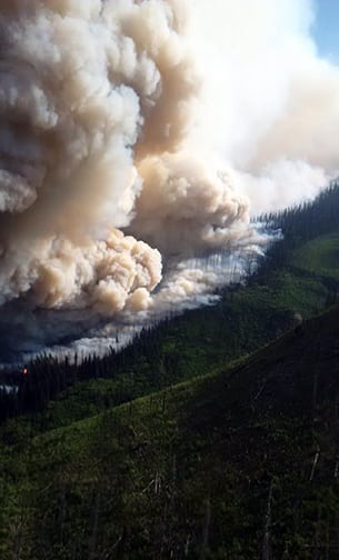 Parks Canada continues to manage the Wardle wildfire in Kootenay National Park. There are no significant changes to the wildfire since August 12, which is now approximately 3,600 hectares in scale. Today there are 150 firefighting personnel, 12 helicopters and nine pieces of heavy equipment on the fire, which does not pose a risk to any local communities.
Fire crews and heavy equipment continue to work to establish containment lines to help stop the spread of the Wardle wildfire in the Vermilion Valley.
Crews are working on the ground at the fire perimeter and along Highway 93 to extinguish active fire, limit growth and ensure the safety of the public. Helicopters are intensively water bucketing the fire perimeter and supporting ground crews, Parks Canada reported.
Highway 93 through Kootenay National Park continues to be affected by wildfire, smoke and fire suppression activities, and is subject to temporary closures to ensure the safety of the public. The highway is open at this time under a travel advisory warning it could close at a moment’s notice. Check with DriveBC for updates.
When Highway 93 is open, the portion of the highway from the Paint Pots to Olive Lake is a no stopping zone for the safety of the public and fire personnel.
Travelling between 7 a.m. and 2 p.m. is recommended. Fire activity is more likely to be reduced during these hours; however, smoke may still affect visibility.
Motorists should be prepared to wait at roadblocks intermittently or long-term with little notice. Travellers should be prepared with enough fuel and supplies in case they are required to turn around and take an alternate route via Highway 1 to Golden and then south on Highway 95. Or enter B.C. via Crowsnest Pass and Highway 3.
The following factors are evaluated when closing and opening the highway: the risk of falling trees onto the highway; anticipated movement of fire in the area; and heavy amounts of smoke that could affect visibility.
WHAT IS OPEN
North Kootenay National Park
Vista Lake to Twin Lakes trail
Boom Lake trail
Great Divide day-use area
Stanley Glacier trail
Marble Canyon day-use area and campground
Paint Pots day-use area
Storm Mountain Lodge
Shadow Lake Lodge
South Kootenay National Park
Radium Hot Pools
Kootenay Valley Viewpoint
Juniper loop / Redstreak trail
Redstreak Creek and Kimpton Creek trails
Kindersley/Sinclair Loop
Redstreak Campground
AREA CLOSURES:
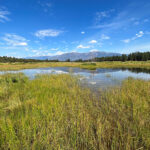
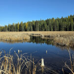
All trails, backcountry campgrounds and day-use areas remain closed from Rockwall trail south to Cobb Lake trail, including Kootenay River day-use area, McLeod Meadows Campground, Dog Lake trail, Kootenay River boat access and Kootenay Park Lodge.
The Whitetail Creek wildfire, in the Beaverfoot Valley has entered Kootenay National Park at the western boundary. The area within Kootenay National Park is estimated at less than one hectare. This wildfire continues to be managed by BC Wildfire Service.
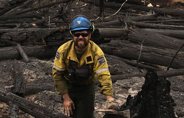
Lead image: A Parks Canada firefighter works on the Wardle wildfire. Parks Canada photo
e-KNOW