Home »
Water mapping underway in upper Columbia Valley
The increasing intensity and severity of wildfires in British Columbia is a growing concern and many rural communities are experiencing the impacts of prolonged drought and limited water resources.
To support wildfire suppression efforts, Living Lakes Canada is expanding its water resource mapping project to include Parson and surrounding neighbourhoods, in partnership with the Parson Community Hall.
“We’re helping emergency responders find and access water more quickly,” said Paige Thurston, Program Manager with Living Lakes. “By compiling local knowledge and water monitoring data, this project is working to protect homes, lives, and ecosystems from the impacts of increasingly intense wildfires.”
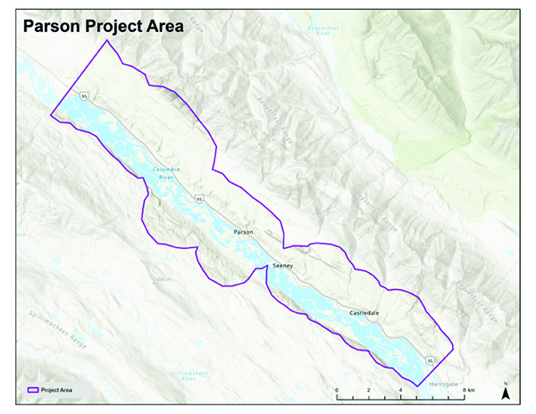 The project area encompasses the communities of McMurdo, Parson, Seeney and Castledale.
Data will be gathered throughout 2026. The final reports and maps will be released in 2027.
Two versions of the maps will be produced: a public version with sensitive details removed, and a professional version accessible only to community partners and wildfire response agencies.
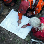
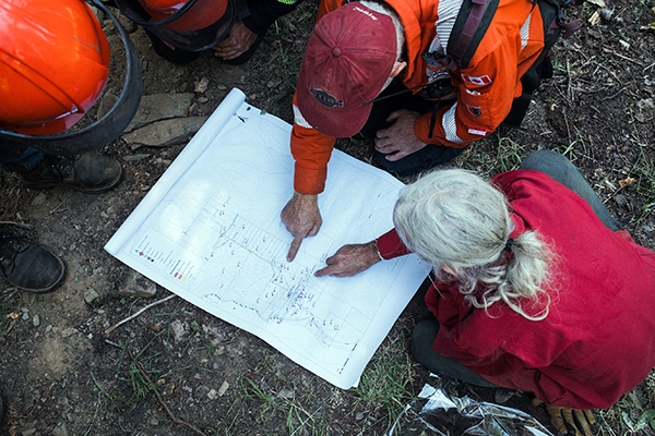
The approach has already demonstrated its value. During the 2024 Argenta Creek wildfire, maps developed by Living Lakes Canada in collaboration with the Argenta Safety & Preparedness Society were used by BC Wildfire Service to support their response. Fire crews reported that the maps significantly cut down the time needed for field reconnaissance.
The project is rooted in community collaboration. In each area, Living Lakes works closely with a local partner and designated Community Champion who act as a liaison and garner community participation.
“We were extremely lucky that we had fast response times and easy access during the big Parson fire two years ago, but we might not be as lucky next time. Anything that we can do to help speed up and streamline firefighting help in an emergency will be invaluable. I am super grateful that our area was picked for this project this year, it will just help us to be ready in case of another fire event,” said Trina Wolfenden, Community Champion for the Parson area.
Residents are invited to share their knowledge of creeks, standpipes, hydrants, access routes and other important features on both public and private lands (with landowner
consent). This on-the-ground information, often missing from existing emergency response systems, is combined with scientific water data to create detailed, interactive maps.
Participation is voluntary, and data from private lands will only be included with landowners’ consent.
A community meeting is being held to share project information and invite local participation:
Parson Community Hall – 3589 Highway 95, Parson;
May 4 from 5 – 7 p.m.
No registration is required. Pizza will be served.
For more information, please visit www.livinglakescanada.ca/wildfire.
If you are unable to attend the meeting, but are interested in contributing local knowledge to the project, please contact [email protected] or call Trina Wolfenden at 250-344-0925.
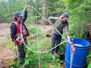
Lead image: ASAP members study water resources map. Louis Bockner Photo
Living Lakes Canada