Home »

Dose of snow and cold coming: Mainroad
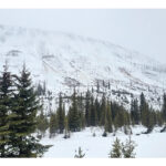
Mainroad East Kootenay Contracting Ltd. is warning residents about a weather event anticipated to impact the East Kootenay over the next 48 hours, with snowfall starting late Thursday night/ Friday morning across the region. The weather event is forecast to continue until Saturday evening.
Mainroad’s meteorological service is tracking an Arctic cold front carrying large amounts of Pacific moisture, resulting in increasingly heavy snowfall over the next few days.
The forecasts are showing chances of flurries or light snow starting Friday morning; this is expected to turn to heavier snowfall overnight Friday and into Saturday.
“We expect to see up to 12 cm of snow by Saturday morning in most areas of Service Area 11 (including the East Kootenay), with the heaviest snowfall rates on Saturday morning,” Mainroad stated.
Starting tonight (March 13) the forecasts include wind around 20 km/h gusting to 40 km/h. Starting Saturday, the forecasts show plunging temperatures
“We expect air temperatures below -16 C in many areas after Saturday morning. After Saturday afternoon we expect mostly cold and dry conditions for the next several days,” Mainroad said.
“Mainroad crews have been proactively applying anti-ice chemicals to major roadways over the past two days. This pre-treatment will assist with snow removal during the weather event by preventing ice from bonding to the surface. It will also help us to achieve clear road conditions much faster, once the event ends. If temperatures drop substantially as expected, the effectiveness of anti-icing chemicals will be limited, and drivers will notice more use of winter abrasive (sand) as a traction agent instead,” the highways maintenance contractor advised.
e-KNOW