Home »
Water resource mapping to support wildfire response in region
The increasing intensity and severity of wildfires in British Columbia is a growing concern and many rural communities are experiencing the impacts of prolonged drought and limited water resources.
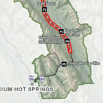
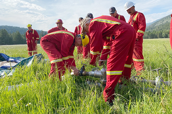
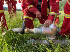
To support wildfire suppression efforts, Living Lakes Canada is expanding its water resource mapping project to include Grasmere and Yaq̓it ʔa·knuqⱡi’it in the East Kootenay. Local partners on the project include Yaq̓it ʔa·knuqⱡi’it Fire Brigade and Grasmere Community Society.
“Mapping in advance of a fire event will assist local and external response teams by adding a concise and usable system that will allow them to operate at greater efficiency and speed should an event occur,” said Wade Oestreich, Director of Fire and Emergency Services for Yaq̓it ʔa·knuqⱡi ‘it First Nation. “This system will compile local knowledge that will be regionally specific and lessen the workload while teams are working an emergency.”
This initiative builds on a successful 2024 pilot project in Argenta, where Living Lakes collaborated with the Argenta Safety and Preparedness Society (ASAP). Together, they developed comprehensive digital maps identifying all water sources in the region to help quickly orient wildfire crews during emergencies.
One month after the report was published, the Argenta Creek Wildfire broke out. The new resource played a key role in supporting BC Wildfire Service with accelerated response time and may have saved portions of the Argenta community, with only one small building lost to the wildfire.
Many East Kootenay communities face challenges when locating substantial water sources to fight approaching fires. By combining water data and modelling from Living Lakes’ Columbia Basin Water Monitoring Framework with local community knowledge, this wildfire response project details water access points and projected flows, high-pressure standpipes, pump deployment sites in streams, locations of buildings and residences, and access routes.

“Locals have the best knowledge about the area. Involving the locals gives them ownership of the project,” said Yvonne Miller, President of the Grasmere Community Society. “It gives me great hope for the future to have Yaq̓it ʔa·knuqⱡi’it and the Grasmere community working together on this project to keep the whole community safe.”
The Grasmere/Yaq̓it ʔa·knuqⱡi’it project area extends north beyond the town of Grasmere to Canyon Cut-Off Road, and south to Roosville on the Canada-U.S. border.
Local community members can support the project by sharing information about potential water sources, including creeks and agricultural or household irrigation systems via an online questionnaire. Participation is voluntary, and data from private lands will only be included with landowners’ consent.
Data will be integrated from open data sources, and both public and private lands throughout the summer of 2025. The final reports and maps will be released in 2026. Two versions of the maps will be produced: a public version with sensitive details removed, and a professional version accessible only to community partners and wildfire response agencies.
This project is generously supported by the Columbia Basin Trust.
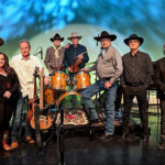
Lead image: Yaq̓it ʔa·knuqⱡi’it Fire Brigade. Yvonne Miller photos
Living Lakes Canada