Home »
Control work ongoing on Bill Nye fire
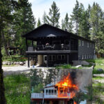
The BC Wildfire Service (BCWS) today reports work continues apace the Bill Nye Mountain wildfire, seven km southeast of Wasa.
Discovered Thursday, July 8, the lightning-caused fire is now an estimated 2,990 hectares.
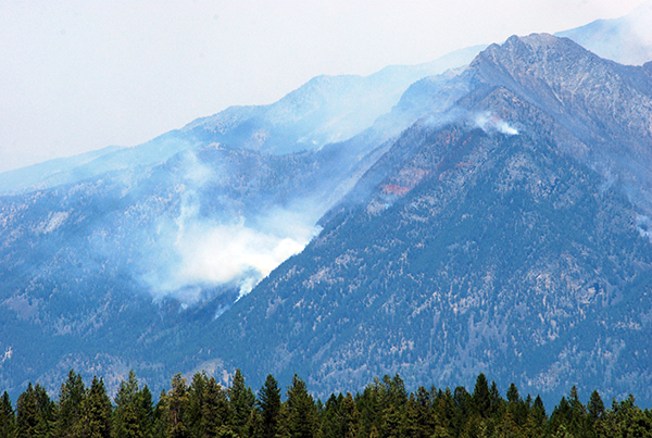
“On Thursday, ground crews continue to work on establishing new control lines on the north flank and patrolling and mopping up on the west flank in preparation for thermal imaging (a drone scan) later this week,” BCWS reported August 5. “Helicopters continue to conduct aerial monitoring of the fire and are available to support ground crews with bucketing if needed, though this is not anticipated under current conditions. Heavy equipment continues to improve control lines.
“The fire has been mainly a smouldering ground fire (rank 1) for the past day, though gusting winds from thunderstorms at higher elevations brought isolated areas of rank 4 behaviour (a highly vigorous surface fire with torching, or passive crown fire).”
Ongoing challenges for firefighters include: extreme slopes, heavy concentrations of fuel, poor access, poor visibility due to heavy smoke/weather.
“Smoke density is expected to increase on Thursday across the Southeast Fire Centre, especially at higher elevations, with temperatures ranging from the mid-20s to low-30s. There is a low to moderate risk of dry lightning in the Cranbrook area and potential for lightning accompanied by precipitation in the Columbia Fire Zone. Temperatures Friday are expected to be slightly cooler, with winds relatively mild at 10-25 km/h,” BCWS said.
A Regional District of East Kootenay Evacuation Alert is in effect, after an evacuation order was rescinded August 3.
An Area Restriction in the vicinity of this fire is in effect.
Today there are 75 firefighters, a helicopter and two pieces of heavy equipment fighting the fire.
Regional wildfire update
BCWS this morning reported a new fire overnight in the East Kootenay, and one near Wynndel.
 However, by this afternoon one fire was out and the other under control.
There was an estimated .01-hectare fire located approximately 3.6 km east of Silver Spring Lake in the high country. Silver Spring Lake is about two km east of Elko. The suspected cause of the fire was lightning.
There was also a fire just east of the Duck Creek Forest Service Road about one km northwest of Wynndel. Believed to be caused by lightning, the fire is also an estimated .01 ha and is under control.
There is another new lightning caused fire, at an estimated 10 ha, in Haatsa Creek, on a south slope above the St. Mary River, about 24 km east of Riondel.
That fire is about eight km north of the Armour Creek fire, which remains out-of-control at 154 ha. The lightning-caused fire was discovered July 24.
The Tanglefoot Creek fire, discovered July 16 about 15 km southeast of the Bill Nye fire, remains out-of-control and has grown to 393 ha.
The Dewar Creek wildfire in St. Mary Alpine Provincial Park, 36 km northwest of Kimberley, remains out-of-control but holding at 58 ha.
The Mineral Creek fire, 25 kilometres southwest of Invermere, is being held at 103 ha.
The Ptarmigan Creek fire, north of Whiteswan Lake Provincial Park, is being held at 62 ha.
And the Marion Lake fire near Parson and Harrogate is still under control at 40 ha.
Lead image: The Bill Nye Mountain wildfire has now been burning for four weeks. e-KNOW file photo
e-KNOW