Home »

Friday Highways Report for the East Kootenay
With winter officially getting underway tomorrow, e-KNOW is once again firing up our Friday Highways Report for the East Kootenay to give the travelling public a glimpse of what they may be heading into or out of.
To begin, Mainroad East Kootenay Contracting Ltd. reported the region received 10 to 20 cm of snow during the night and DriveBC reports winter driving conditions throughout the region.
“The weather has since started to change over from snowy conditions to rain/snow and rain in areas. This mixture causes snow that that fell overnight to melt more rapidly and can cause sudden changes in road conditions due to cooler road surface temperatures,” Mainroad stated in a stakeholder’s update.
Drivers can expect slushy, slippery conditions over the next couple of hours throughout the region. Mainroad crews are out applying de-icing chemicals and winter abrasives, while still performing snow removal.
A mix of snow/rain is expected throughout the day at higher elevations, and 10 to 15 mm of rain in the valleys. Motorists please adjust your driving to the conditions and stay safe.

Before proceeding, please note the DriveBC highway updates shown are generally a few hours old. You can view East Kootenay DriveBC highway cameras on e-KNOW’s front page, too.
Highway 43
Sparwood to Elkford – Winter driving conditions; watch for slippery sections and slushy sections. Compact snow. Rain on compact snow.
Highway 3
Sparwood to B.C. and Alberta Border – Winter driving conditions between Michel Mouth Bridge and BC/AB Border for 17.8 km. Watch for slippery sections. Compact snow. Slushy with slippery sections. Rain on compact snow.

Sparwood to Fernie – Winter driving conditions between Riverside Drive and Michel Mouth Bridge for 32.4 km. Compact snow. Slushy with slippery sections. Rain on compact snow.
Fernie to Elko – Winter driving conditions; watch for slippery sections and slushy sections.
Highway 3/93
Elko to Cranbrook – Winter driving conditions, with slushy sections. Slushy with slippery sections.
Highway 3/95
Curzon Junction to Moyie – Winter driving conditions.

Highway 93/95
Fort Steele to Canal Flats – Limited visibility with heavy snowfall between Highway 3 and Canal Flats Cut-Off Rd for 72.5 km. Winter driving conditions.

Canal Flats to Radium Hot Springs – Winter driving conditions with slushy sections. Freezing rain.
 Highway 95A
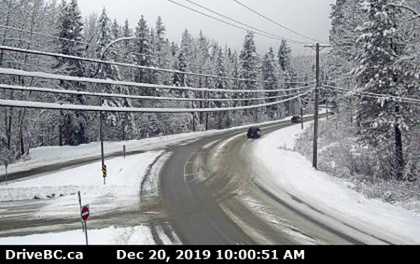
Cranbrook to Kimberley – Winter driving conditions with slushy sections. Compact snow. Pictured above: Kimberley, below Cranbrook.
 Wasa Junction to Kimberley – Winter driving conditions; compact snow.
Highway 93
Radium Hot Springs to 36 km south of Alberta Border – Expect blowing snow between. Watch for slippery sections. Compact snow.
Montana border to Highway 3 – Winter driving conditions for 36.7 km. Watch for slippery and slushy sections.
Highway 95
Radium Hot Springs to Golden – Watch for slippery sections and compact snow.

Curzon Junction to Kingsgate – Winter driving conditions for 11.2 km. Limited visibility with snow. Watch for slippery and slushy sections. Compact snow.
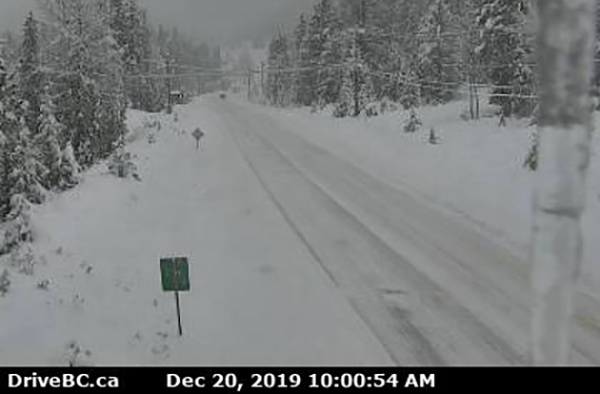 Toby Creek Road/Panorama (above)
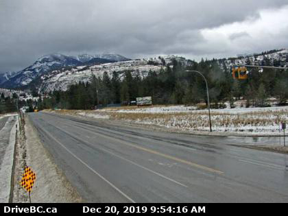
Lead image: Radium Junction – Highway 93 and 95 earlier this morning (Dec. 20). All images from DriveBC
e-KNOW