Home »

New lightning-caused wildfires reported in region
 Seven new wildfires were started yesterday and overnight by lightning in the East Kootenay, while a couple of other fires expanded in size.
There is a .5 hectare fire in the Goat Creek area of the Van Nostrand Range, east of Top of the World Provincial Park.
Two fires are burning to the east of that fire, with one in the Nordstrom Creek area (.01 ha) and another nine km due north at Weigert Creek.
A new fire is burning in the Barkshanty Creek area (.16 ha), south of Cranbrook and about five km northeast of Moyie.
A trio of lightning-caused fires are burning 50-55 km southeast of Cranbrook.
A .3 ha wildfire discovered overnight is burning northeast of Mt. Fitzpatrick, with a first fire, now at .11 ha, discovered August 9 northwest of the mountain. Each fire is about four km from the US border.
These go along with a .9 ha fire burning in Bloom Creek, about seven km to the northwest.
A lightning caused fire (.01 ha) began last night in the Lizard Range, southwest of Fernie.
Finally, a .09 ha person-caused fire is being reported by the BC Wildfire Service (BCWS) in the Moberly Creek area, about 11 km northwest of Golden.
The Lamb Creek fire, about eight km southwest of Monroe Lake, is now at about 20 ha. The fire was discovered August 7. Another fire started that night, at Sunrise Creek, is still at about .01 ha.
As for the well-established big fires, the Island Pond wildfire 12 km south of Canal Flats is still reported by BCWS as 75% contained, at about 1,073 ha.

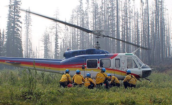
Eighty-eight firefighters, helicopters and eight pieces of heavy equipment remain engaged in the battle to halt the fire, discovered 13 days ago.
The evacuation alert issued by the Regional District of East Kootenay for the Island Pond, Sheep Creek and Premier Lake Provincial Park areas remains in effect.
In its report this morning the BCWS noted: “Fire suppression efforts will be supported by helicopters and heavy equipment today. Crews are making good progress on the south flank. A successful burn-off operation took place along the east flank. Water delivery continues around the fire perimeter. The public can expect to see increased smoke from this fire. No significant change overnight.”
The Grave Creek fire, about 33 km east of Canal Flats, is now at 400 ha. This blaze was discovered August 8.
The White River fire remains a beast. Now at 1,550 ha, the lightning-caused fire discovered on July 29, is being assessed by crews today as they prepare for potential burn-off operations. Burn-off operations will occur when the weather permits, BCWS said.
Public access to the White-Middle Fork Forest Service Road remains prohibited at the 45.5 kilometre point. The Lands Manager of the Rocky Mountain Natural Resource District ordered the road closure due to concerns about public safety.
Finally, the Verdant Creek wildfire in Kootenay National Park and Mount Assiniboine Provincial Park, discovered July 15, is at 13,500 ha, with the status quo remaining.
The fire continues to wreak havoc on the Columbia Valley’s peak tourism season, with traffic counts down substantially on the Trans-Canada at Banff and periodic closures of Highway 93 due to fire and smoke.
Check with DriveBC for updates on the highway.
Keep up-to-date on the wildfire situation by visiting the BCWS’s Active Wildfires webpage.
There are currently 15 fires burning in the East Kootenay.
Lead image: A bomber hits the Lamb Creek wildfire. Photo by Linda Botterill
e-KNOW