Home »

Warm weather raising potential for major flood
 “Perceptions,” by Gerry Warner
Op-Ed Commentary
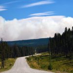
Have you taken a good look at the mountains lately – the Rockies, the Purcells, Baker Mountain (pictured), the one with all those towers on it? If you’ve looked, there’s one thing you can’t help but notice.
There’s a motherlode of snow on all the local peaks and ridges and so far this cold spring not much of that snow has melted and that’s the problem. If it finally warms up – and we’re supposedly in for a week of warm weather now – there could be big trouble ahead in the Kootenays and the rest of B.C.
FLOOD!
I’ve spelled the word in caps because the flood potential this spring is truly awesome, and in a few weeks, we’re going to know because all that snow is going to melt and the only question is how quickly. But before I go any further I’d like to emphasize that I’m not the proverbial little boy calling wolf.
While high water is virtually a certainty this year a flood doesn’t necessarily follow. It all depends on how quickly the snow melts. Even if we have a hot spell now it won’t mean more than local flooding at valley bottom elevations. What will cause a major flood – a so-called 200-year flood – is a heat wave in mid-May or early June. That’s a scenario that could cause a flood of catastrophic proportions and it’s happened in the province before, but not when most people think.
Yes there was a bad flood in 1948 when the dikes broke in the lower Fraser Valley, water surged through downtown Trail and houses floated down Mark Creek in Kimberley. But, believe it or not, that wasn’t the 200-year flood level that flood forecasters refer to. The last time that happened was 1894 when B.C. was still in its infancy and towns like Cranbrook and Kimberley barely existed. Vancouver barely existed then but there was some habitation in the province then and the damage was truly catastrophic and it’s documented in government records.
The document is called “Flooding and Landslide Events Southern British Columbia 1808 – 2006” by D. Septer and is an official BC Ministry of Environment document. On page 21, it says the following: “During the winter of 1893-94 record snowfalls were recorded in many of B.C.’s Interior mountains. The spring of 1894 was cold and wet. (Sound familiar?) Of the first 15 days in May, 10 were wet. In the remaining fortnight, there were 11 fine warm days.”
And after a few rainy days, these were followed by even hotter days that extended into early June. And the result? “The greatest flood known to the early white man,” but not unknown to the aboriginal people of B.C. who lived in the province for hundreds of generations before.
The document continues: “Almost all bridges were swept away near Chilliwack . . . Col. James Baker (that’s our Col. Baker, who was Provincial Secretary at the time) reported on the evening of June 4 he was able to pull in a boat up to the Queen’s Hotel (in Chilliwack) . . . a series of washouts on the CPR line west of the Rocky Mountains severed train connections with eastern Canada for 41 days . . . in the Fort Steele District, four bridges were carried away . . . on account of the high water, about 150 Native Indians at the Saint Eugene Mission mine (in Moyie) were unable to mine.
Kootenay Lake rose to unprecedented heights . . . the Kootenay River flooded all the bottomlands turning the country into one vast lake. A steamer could sail from the head of Kootenay Lake to 10 miles (16 km) south of the (American) boundary, a distance of 60 mi.”
The flood of 1894 also caused havoc around the province and the Lower Mainland.
“Floods on the Columbia River were interrupting rail traffic at Golden . . . at Matsqui the water was up to the top of the telegraph poles . . . On May 31 in Vancouver, the Fraser River, with large amounts of debris, backed up into Burrard Inlet . . . mail from Vancouver and Victoria for eastern points was forwarded via San Francisco . . . all bridges on the Kettle river were lost.”
And there was loss of life: “Workmen found a small raft floating on the Fraser River at Ruby Creek carrying the dead bodies of an entire family of five.”
That’s what you call a catastrophic flood! Could it happen again? No one knows for sure, but the potential is definitely there this year. We’ll have a much better idea next week when the provincial River Forecast Centre issues its April snowpack report.
In March the snowpack was averaging close to 150% of normal in parts of the province, giving great cause for concern.
We’ve got about a month to prepare for this possible calamity. After then, it will be too late to call Noah.
– Gerry Warner is a retired journalist who’s got his kayak ready just in case.
