Home »

Elk Valley Trail (Trans Canada) Update
By Robert Champagne

While most of us in the Elk Valley were staying warm and dry through our wet autumn, deep in the woods all around us, much work has been done to continue construction of the Trans Canada Trail, all the way from Round Prairie (just north of Elkford) to Elko.
During the peak of construction activity, there were nine crews from seven companies working consecutively along the trail. Each crew consists of a mini excavator and operator roughing in the trail plus one or two assistants who do chainsaw work, corridor clearing, and trail tread finishing with hand tools.
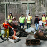
What a great collaboration of the communities in the Elk Valley! Here are some of the highlights, broken down by sections.
Round Prairie to Elkford

The eight km Mountain Walk trail is complete. The trail involved constructing nine re-routes totalling approximately 5.4 km and upgrading 2.6 km of existing trail.
A seven-metre bridge was installed over Crossing Creek at the north end of the trail.
Kiosks have been installed at the north (Round Prairie) and south (Wapiti Ski Hill) ends of the trail.
This is an excellent cycling trail with great views, particularly the northern half. Trail users are reminded that the trail surface will be loose and prone to damage until the tread naturally compacts; please avoid cycling during wet conditions. Trail users are also reminded that this is a provincially designated non-motorized trail.

Elkford to Line Creek
Work is nearing completion on the new 1.6 km Elkford South trail that connects the Fording River Road to the north end of the Sulphur Springs road. This trail traverses a diverse mix of terrain and vegetation. Installing a very large culvert is the only item remaining and will be done in spring 2017, when the trail is dry and firm enough to transport it in to the site on a wheeled cart without damaging the trail tread.
A new 800 m section of trail that passes adjacent to the Sulphur Springs and rejoins the main road farther south was completed by Cornerstone Excavation in a one day blitz with two crews in mid-October.

Line Creek to Sparwood
Within the District of Sparwood, both the Cypress trail and the Whiskey Jack frontage trail are complete.
Permission from Teck for the proposed Wilson Corner/Lower Elk Valley Road section has been put on hold due to concerns with the trail impacting wildlife. Alternative alignments are being investigated, the most likely option being on the west side of the Lower Elk Valley Rd.

Road signage along Highway 43 and Lower Elk Valley Road will be installed by the Ministry of Transportation and Infrastructure (MOTI) next year.
Sparwood to Hosmer
A combination of trail upgrades, trail re-routes and new trail construction have been done on a 7.5 km section of the trail leading south from the entrance to the Sparwood Golf Course.

Work is complete on a five km section of the Coal Discovery Trail in the Ingham Creek area. It is a diverse mixture of new machine built trail construction, upgrades to existing trail, some new hand built trail, and bridge installation.
The owners of the deactivated road that connects the north end of Stephenson Road with the BC Hydro Powerline have agreed to have the trail run on their land. The road was converted to trail in late October.
Major upgrades to the Coal Discovery Trail between the NCC gravel quarry and Hosmer are required to bring the route up to the standard of the rest of the trail.

The budget for the Sparwood to Hosmer trail section is tight; if funding cannot be found for this work, the BC Hydro powerline road would make for an acceptable alternative.
Hosmer to Fernie
There is no trail yet between Hosmer and Porky Blue Creek. For 2016, the route will follow the BC Hydro road as there is insufficient funding to do trail construction this year.
The Fernie Trail Alliance (FTA) is hoping to generate funding to construct this section in 2017, resulting in a full trail connection between Hosmer and Fernie, reducing the amount of road on the Elk Valley Trail between Sparwood and Fernie to less than 3 km. The cost to construct this section is estimated to be $100,000 including bridges and culverts. The cost could be reduced by utilizing roads in places where the trail alignment would need to parallel them in close proximity.

DIG Trail Design has made a great start on reconstructing a 2.6 km section at the north end of the Coal Discovery Trail, working south from Porky Blue. This progressed well despite some significant challenges;
– Natural drainage patterns have been altered due to logging which has required management of water in numerous places;
– Wetter than normal weather this fall;
– Having to cross and in some cases follow temporary skid trails that have been re-contoured – these are particularly challenging for trail building;
– The road system that was used to harvest the area is currently
decommissioned, requiring flexibility and creativity to come up with alternate ways to access the trail with crew, materials, and equipment. Jemi Fibre has assisted by using an excavator to transport large timbers into a bridge site on a decommissioned road. Work has been paused on this section for the season, with completion scheduled for spring 2017.
Trail upgrades and re-routes are scheduled on the section of the Coal Discovery Trail between the Jemi Fibre property line and Fernie for spring 2017.

Fernie to Morrissey
The entire section that includes the Fernie landfill bypass trail, the Montane trails, and the Roots to Branch H trail are complete. Signage is now in place on this section. Volunteers from the Fernie Trails Alliance are currently working with Parastone Developments on some trail drainage upgrades on the upper Montane trail. Positive reports continue to be received for this section.

The Backcountry Trail Experts have nearly completed the 5.9 km Branch H to Cokato Road new trail section. This trail section has been challenging, with steep terrain and many creeks and gullies that needed to be crossed. Fresh cut blocks along the route has also made for some difficult trail construction with altered surface and ground water drainage patterns requiring mitigation through ditching and culvert installation. A fence line also needed to be crossed which required installing a custom trail-width cattle guard.

As of early November the entire trail section has been roughed in, but due to the very wet conditions through October, work on this trail section has been put on hold for this season. The Backcountry Trail Experts will complete the trail when things dry out in the spring. Combined with the old Fernie landfill bypass trail, the lower and upper Montane trails, and the Snoop Lion trail, when this section is completed it will total 13.5 km of new single track, with a short 1.5 km section of double track on an old road in the middle.
Please note that the last kilometre of trail near Three Kings area is very muddy and should be avoided, at least until the ground freezes.

Morrissey to Elko
The Nature Conservancy of Canada (NCC) requires a land use agreement to utilize existing roadways along the Wigwam River, Wigwam Hill, and along the gas line right of way to the westerly property boundary on the Wigwam Flats.
Permission will also be needed from the Province to designate the trail to follow the existing road across the crown land portion of the Wigwam Flats to Elko.
Authorization has been granted by Trans Canada Pipelines to construct the Wigwam Hill trail realignment on their right of way to bring the grades down from the current 25-30%. This section is located on NCC land.
Trans Canada Pipelines has offered to grade the road through the Mount Broadwood Access Management Area from Elko to the Wigwam/Lodgepole gate.
A license of occupation is now in place with BC Hydro to use the access road to the Elko Dam for the Elk Valley Trail.


Kiosks
Ten kiosks have been constructed by Bisaro Woodworks and seven of them have been installed this year by Purcell Pride Contracting. They are: Round Prairie; Wapiti Ski Hill trailhead for the Mtn Walk section; Elkford at the Fording Road bridge over the Elk River; Lower Elk Valley Road; Entrance to the Sparwood Golf Course; Hosmer; and Morrissey

Very soon, kiosks will also be installed in Fernie and at Line Creek, with map panels expected to be attached later in November. The remaining kiosk sites, dependent on the respective permissions being in place, are Wigwam, and Elko.
Have a great fall and winter! Looking forward to seeing you on the trails!
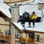
Lead image: A viewpoint along the Mountain Walk Trail near Elkford. Photos submitted