Home »
Columbia and Kicking Horse floodplains mapped
The B.C. government, in partnership with Natural Resources Canada and the Fraser Basin Council, has released new floodplain maps, covering five waterways and 58 communities, under Natural Resources Canada’s Flood Hazard Identification Mapping Program.
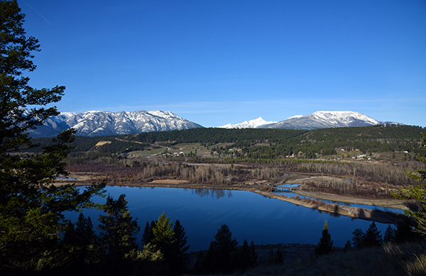
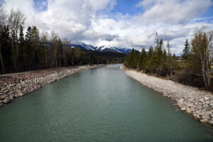
The Upper Columbia and Kicking Horse rivers near Invermere and Golden are included in the mapping.
“Floodplain maps do more than chart where water may go, they reveal where risk lives, reflect how our world is changing and shape how we prepare for the future,” said Randene Neill, B.C.’s Minister of Water, Land and Resource Stewardship. “Updating these maps through the mapping program is one more step in implementing the B.C. Flood Strategy. They help turn insight into action and can go a long way in helping communities make informed choices, plan ahead and act quickly if the time comes.”
Floodplain maps show where and how flooding could happen, as well as potential exposure to flooding of the environment, homes, businesses and infrastructure. Similar to tsunami zone maps, floodplain maps show existing hazards.
Having accurate, updated maps helps local governments, First Nations and professionals plan, prevent or mitigate flood damage to their communities and surrounding ecosystems. This includes informing decisions about land-use planning and development, infrastructure investment and emergency management in a changing climate. All people in British Columbia can use flood-hazard information and these new floodplain maps to make risk-informed decisions for themselves and their families, a Ministry of Water, Land and Resource Stewardship media release said.
Insurance companies use their own tools, data and public information about flood risks to decide where overland flood insurance is available. This type of insurance is usually not included in standard home policies.
New floodplain maps may make it easier for some people to get coverage. The province recommends that homeowners contact their insurance provider to find out what overland flood insurance options are available in their area.
“Improved floodplain mapping is key to increasing our understanding and awareness of the flood risk,” said Aaron Sutherland, Insurance Bureau of Canada vice-president Pacific Region. “By releasing new flood maps, the Province is helping to promote improve land-use decisions and the development of safer, more climate-resilient communities across the province.”
The floodplain maps are being released in two phases, focusing on main rivers and connecting streams. These maps were created following in-depth engagement with local governments and First Nations in each study area.
Floodplain maps are complete for 58 communities around the following waterways:
* Upper Columbia and Kicking Horse Rivers, including near Invermere and Golden;
* Coquihalla and Fraser rivers from Yale to Mission;
* Fraser and Nechako rivers around Prince George and Vanderhoof;
* Bulkley and Skeena rivers from Houston to downstream from Terrace;
* Shuswap Lake and the mainstem rivers that drain into it.
“Having up-to-date floodplain maps gives people and communities crucial information they need so they can make informed decisions and better prepare themselves in the face of a potential flood,” said Kelly Greene, B.C.’s Minister of Emergency Management and Climate Readiness. “These maps will support smarter planning and help protect people, homes and critical infrastructure from increasing flood risks.”
The B.C. Flood Strategy was released in 2024 to build flood preparedness and mitigation throughout the province, providing a foundational road map for integrated flood-hazard management over time. It supports continued action in four key areas:
* understanding flood risks through floodplain mapping and risk assessment;
* strengthening partnerships and governance;
* increasing flood preparedness, response and recovery to support people and communities;
* reducing flood risks for communities through flood resilience.
Launched in 2023, ClimateReadyBC is a one-stop shop for information and data to support communities to mitigate risks from natural hazards, such as residents to prepare their homes and communities for climate threats such as: floods, wildfires, tsunamis and earthquakes.
B.C. has invested more than $38 million in a six-year light detection and ranging (LiDAR) elevation data collection program, giving B.C. communities access to high-quality data to support decision-making about planning and management of natural emergency events, including flooding, the ministry media release noted.
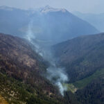
Lead image: Toby Creek enters the Columbia River Wetlands at Invermere. e-KNOW file photos
e-KNOW