Home »
Regional wildfire round up
Entering the weekend, the East Kootenay is without ‘wildfires of note’ but still has six ‘out-of-control’ fires.
Tower Creek wildfire (N10947) – Discovered on July 17; is out-of-control at 1,188 hectares. This wildfire is no longer a Wildfire of Note. The evacuation alert has been amended by the Regional District East Kootenay (RDEK). (Southwest of Kimberley).
Matthew Creek wildfire (N11020) – Discovered on July 18; is out-of-control at 1,825.95 ha. An area restriction remains in place in the Matthew Creek area. (West of Kimberley)
Calamity Creek (N11036) – Discovered on July 18; is out-of-control at 180.89 ha. In the interest of public and responder safety there is an area restriction in effect in the Calamity Creek area as a result of this wildfire. (Southwest of St. Mary’s Alpine Provincial Park).
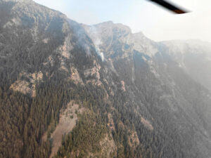
Diorite Creek (N21239) – Discovered on July 26; is out-of-control at 14.45 ha. This wildfire is burning at high elevation, in complex, steep and rocky terrain, making it inoperable and inaccessible for both ground and aviation resources. Because of these conditions, the BC Wildfire Service is using a modified response strategy and continues to actively monitor the fire. (East of Premier Lake).
Jumbo Creek (N21071) – Discovered on July 20; is out-of-control at 1,043 ha. The Jumbo Creek wildfire is a lightning-caused wildfire burning in challenging terrain, where direct suppression activities would provide limited operational benefit while exposing firefighters to unnecessary risk. This incident is not threatening structures or critical infrastructure at this time. As temperatures rise throughout the day, more smoke may be visible as fire activity naturally increases with daytime heating. (West of Panorama Mountain Resort).
McGuire Creek (N11396) – Discovered on August 1 – Out-of-control at 10.3 ha. (North of Grasmere)
Wait Creek (N11360) – Discovered on August 1 – Under control at 1,378 ha. This wildfire is no longer a Wildfire of Note. Operations are still ongoing, expect to continue to see crews, heavy equipment and aviation resources in the area going forwards. While the fire status has changed, this fire remains an active worksite, it will be some time before this fire is called out and crews will be onsite for the foreseeable future. The Regional District of East Kootenay has rescinded all evacuation alerts and orders issued for this wildfire. Find the latest information on their website here. Highway 95A and Highway 93/95 have re-opened to traffic. (East of Kimberley).
Ranger Lake (N11326) – Discovered on July 29 – Est. 22.25 ha – being held. (South of Cranbrook)
Skookumchuck Creek (N21358) – Discovered on August 1. Under control at 20 ha. Upon discovery of this wildfire airtankers blanketed the area with retardant, while helicopters bucketed water to decrease wind-driven fire behaviour and spread. Crews have since established guard around the permitter of the fire and are working to complete wet lining. (West of Skookumchuck)
Lussier Creek (N20809) – Discovered on July 11 – Under control at 115 ha. (Northeast of Skookumchuck).
Columbia Lake West (N21362) – Discovered On August 1 – Under control at .9 ha.
Check BC Wildfire Service’s website for up-to-date information.
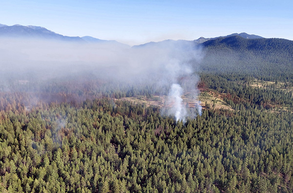
Lead image: The Lussier Creek wildfire. BC Wildfire Service images
e-KNOW