Home »
BC Resource Road Access Survey initiated
Province-wide survey will help identify resource roads that matter most for outdoor recreation access
Much of B.C.’s backcountry recreation depends on resource roads.
These roads provide access to trails, lakes, rivers, cabins, recreation sites, backcountry areas, rural communities and outdoor tourism destinations, but many are not managed or maintained with recreation access in mind. A collaboration of provincial recreation organizations has launched the BC Resource Road Access Survey to better understand which roads and road systems matter most for outdoor recreation across the province.
“As outdoor recreation is increasingly recognized as an important economic and community-building sector in BC, we need a clearer picture of the roads and road systems that communities, clubs, businesses, and outdoor users rely on,” said Louise Pedersen, Executive Director of the Outdoor Recreation Council of BC (ORCBC). “This survey is about gathering local knowledge so we can better understand access priorities, common barriers, and practical solutions.”
 The The BC Resource Road Access Survey is the work of the ORCBC Resource Road Working Group, with participation from the Federation of Mountain Clubs of British Columbia, BC Snowmobile Federation, Four Wheel Drive Association of BC, Quad Riders ATV Association of BC, British Columbia Mountaineering Club, and support from the Service Road Atlas.
Right now, no government agency is specifically responsible for keeping resource roads open for recreation. At the same time, not every resource road has the same role or level of importance. In some places, access may also need to be managed carefully to protect wildlife, cultural values, sensitive ecosystems, public safety and other important interests.
The survey asks recreation groups, tourism operators, businesses, local organizations, communities and outdoor users to identify resource roads that are currently used for recreation, roads that may be at risk of closure or deactivation, and roads where access has already been lost, limited or made difficult.
The information gathered will help build a provincial inventory of recreation-important resource roads and support future conversations with the province, local and Indigenous governments, recreation organizations, industry, land managers, funders and other partners.
The survey also asks respondents to identify barriers such as gates, washouts, missing bridges or culverts, poor road conditions, seasonal closures, wildlife management closures and other access challenges. Respondents are also invited to share possible solutions, including shared maintenance agreements, signage improvements, seasonal maintenance, risk assessments, reroutes and funding for priority recreation access routes.
“We know that local recreation groups and outdoor users often have the best information about what is happening on the ground,” said Monika Bittel, Recreation and Access Chair with the Federation of Mountain Clubs of BC.
“By bringing that knowledge together, we can help make the case for more coordinated planning and investment in the roads that support recreation access across B.C.”
Recreation users are invited to complete one survey for each recreation destination or road system and may submit as many surveys as they want. The survey should take about 10 to 20 minutes to complete, depending on the amount of information provided.
Respondents do not need to have perfect information. Local knowledge, best estimates, photos, maps, examples and stories are all helpful.
“Everyone who uses resource roads to access the backcountry has a role to play in this work,” said Chris D’Silva, President of the Quad Riders ATV Association of BC.
“We encourage outdoor recreation users to complete the survey for the roads and road systems that matter to them, so government has a clearer picture of how important these routes are to communities and recreation users across the province.”
“It is up to those of us who travel and rely on backcountry roads to speak up for their value,” said Brian Pratt, Director of Regions with the Four Wheel Drive Association of BC. “These roads support forestry, recreation, tourism and resource access, but they also connect people to the outdoors, to family time and to community life. Their value goes far beyond dollars and cents.”
Recreation groups, businesses, local governments, tourism operators and individual outdoor users are encouraged to share the survey widely within their networks.
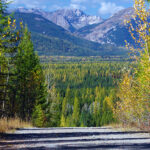
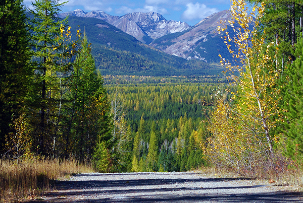
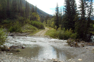
Lead image: Kishinena FSR leading down to Flathead Valley in southeastern East Kootenay. e-KNOW file photos
Outdoor Recreation Council of BC