Home »

Winter Storm Watch and Weather Alert issued
Environment Canada has issued a Winter Storm Watch for the Elk Valley and a Special Weather Statement warning of significant snowfall and cooling weather forecasted for the rest of the East Kootenay over the next few days.
A significant snowstorm is forecasted for Tuesday (Dec. 19) and temperatures are expected to become colder after Thursday. Up to 25 cm of snow is expected Tuesday in the Elk Valley.
“An approaching moisture-laden warm front will bring heavy snow to the Boundary, West Kootenay and Elk Valley regions on Tuesday. The snow will start falling shortly after midnight and then become heavy at times beginning mid morning. The heavy snowfall will taper off after midnight on Wednesday,” Environment Canada reported this morning.
The greatest accumulation of snow in the Elk Valley is expected for the City of Fernie and along Highway 3 south to Elko. Significant, but lesser amounts are expected for Sparwood.
Heavy accumulations of snow are expected in southern regions such as the City of Trail. Significant, but lesser amounts are expected for Castlegar. Snowfall amount likely exceeding 25 cm for Kootenay Pass.
This winter storm watch may be upgraded to a warning once greater certainty is achieved regarding snowfall amounts and specific locations impacted, Environment Canada added.
On Tuesday a deepening Pacific low pressure system will track up and across northern Washington state. This system will combine plentiful moisture with cool northerly winds near the surface. The result will be heavy snow starting tonight and continuing through Wednesday morning for most communities in the southwestern Interior and Kootenays.
Storm total snowfall amounts will range from 15 to 25 cm with the highest amounts falling near the U.S. border.
A break in the weather is forecast later Wednesday before an Arctic front sweeps through on Thursday. The Arctic front will bring a few flurries and, more noticeably, colder air to the southern interior for the rest of the week. Overnight lows will drop to between minus 10 and minus 15; daytime maximums will be several degrees below zero.
With the degrading weather conditions, highway travel is something that should be only done if absolutely necessary.
Environment Canada and Mainroad East Kootenay Contracting have both issued travel warnings.
“Rapidly accumulating snow could make travel difficult over some locations. Visibility may be suddenly reduced at times in heavy snow. If you must travel, keep others informed of your schedule and destination and carry an emergency kit and mobile phone,” Environment Canada said.
“The forecast looks much the same this morning with heavy snow expected throughout Tuesday and into Wednesday. Accumulations in the 15-25cm range are forecast. During the snowfall period temperatures will be dropping and winds picking up so limited visibility due to blowing snow is likely,” Mainroad noted this morning (Dec. 17).
“By Saturday, this system will have passed bringing temperatures in the -15C to -25C range with the colder temperatures in the Elk Valley region. Winds will drop off but wind chill remains a hazard.
“Holiday travellers and commuters should be prepared for severe winter conditions and leave plenty of extra time. As always, before you drive, please visit www.drivebc.ca for the current road conditions and allow for some extra time to reach your destination,” Mainroad stated.
At this time Highway 93 through Kootenay National Park is closed between Radium Hot Springs and Castle Mountain Junction because of heavy snow fall. Estimated time of opening is noon today. Check with DriveBC for updates.
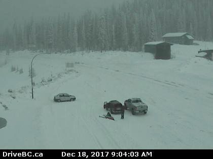
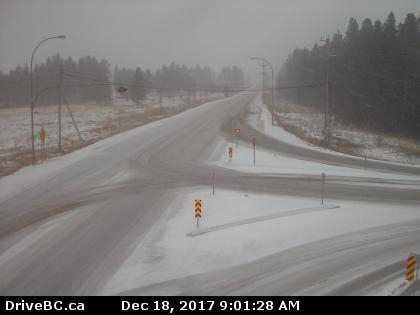
Lead image: Highway 93/95 junction at Radium Hot Springs. DriveBC images
e-KNOW