Home »
Significant progress reported on Wardle fire
 Parks Canada reported this morning that “significant progress” has been made toward containing the Wardle wildfire in Kootenay National Park and it is now being held at 3,600 hectares.
“This means that the fire is not expected to spread beyond existing or predetermined boundaries, given prevailing and forecasted conditions,” Parks Canada stated in an update.
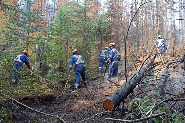
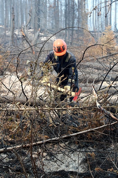
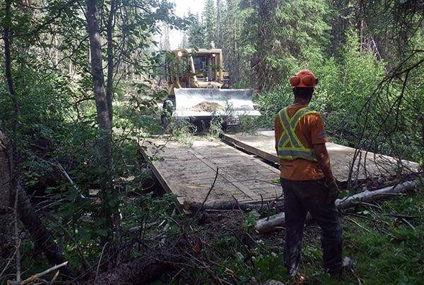
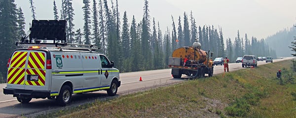
“Fire and highway crews continue to work on the wildfire and keep Highway 93 open. Many of the personnel are working along the highway to extinguish active fire, limit growth and ensure the safety of the public. For their safety, and that of all travellers, traffic calming measures are in place.”
Highway 93 through Kootenay National Park continues to be affected by wildfire, smoke and fire suppression activities, and is subject to temporary closures or reduced speeds to ensure the safety of the public, Parks Canada noted.
For the safety of the public and fire personnel, a no stopping zone through the fire-affected area along Highway 93 remains in effect.
Today there are 120 firefighting personnel, two pieces of heavy equipment and six helicopters working on the fire.
 AREA CLOSURES
• As of Monday morning, August 20, two area closures at the north end of Kootenay National Park are lifted, including northern section of the Rockwall trail north of Tumbling Pass.
• The southern section of the Rockwall trail, including Floe Lake Campground and Numa Creek Campground along with the Floe Lake Trail and Numa Creek Trail, remain closed.
• At this time, all trails, backcountry campgrounds and day-use areas remain closed from Numa Falls day-use area south to Cobb Lake trail.
WHAT IS OPEN
North Kootenay National Park
Great Divide day-use area;
Stanley Glacier trail;
Marble Canyon day-use area and campground;
Paint Pots day-use area;
Northern section of the Rockwall trail (north of Tumbling Pass);
Kootenay Park Lodge.
 From 93 South in Banff National Park
Vista Lake to Twin Lakes trail;
Boom Lake trail;
Storm Mountain Lodge;
Shadow Lake Lodge.
South Kootenay National Park
Radium Hot Pools;
Kootenay Valley Viewpoint;
Juniper loop / Redstreak trail;
Redstreak Creek and Kimpton Creek trails;
Kindersley/Sinclair Loop;
Redstreak Campground.
Cross River Wildfire
The Cross River wildfire south of Kootenay National Park, is being managed by BC Wildfire Service and is visible from Kootenay Valley Viewpoint. Settlers Road through Kootenay National Park is closed due to this wildfire. information on
Whitetail Creek Wildfire
The Whitetail Creek wildfire, in the Beaverfoot Valley has entered Kootenay National Park at the western boundary. The area within Kootenay National Park is estimated at 20 hectares. Parks Canada is assisting BC Wildfire Service in the management of the Whitetail Creek wildfire.
Images courtesy Parks Canada
e-KNOW